

December 15, 2021, will forever stand apart in Iowa’s weather history. What unfolded that evening was not just unusual — it was unprecedented. From record-shattering warmth to a historic tornado outbreak and the nation’s first December derecho, the atmosphere behaved in ways no Iowan had ever witnessed. Even now, four years later, it remains one of the most extraordinary weather events in the modern record.
The National Weather Service Storm Prediction Center issued Iowa’s first-ever December Moderate Risk — a Level 4 out of 5 — signaling the seriousness of the setup. By night’s end, Iowa would break its all-time one-day tornado record with 63 confirmed tornadoes. Of those, 21 were rated EF-2, the most EF-2-or-stronger tornadoes ever documented here in a single day. For perspective, in the previous 70 years, Iowa had recorded only five tornadoes in all Decembers combined.
It wasn’t just the storms that made history. Temperatures soared into the 70s statewide, with several locations reaching 75 degrees — breaking Iowa’s all-time December heat record set in 1939. It felt nothing like winter. It didn’t even feel like fall. It felt like August had been dropped into the middle of the holiday season.
A Meteorological powder keg
A rapidly deepening low pressure system raced from the Rockies into Siouxland, producing a corridor of powerful environmental winds long before storms arrived. By evening, an explosive line of thunderstorms — fueled by exceptional shear from a roaring jet stream — swept across the state. The line produced dozens of tornadoes and widespread wind gusts between 60 and 90 mph. Audubon recorded an 88 mph gust, while an unofficial mesonet observation near Sheffield measured 108 mph during one tornadic circulation.
Even after the storms passed, Iowa’s ordeal wasn’t over. Non-thunderstorm winds surged overnight, topping 80 mph in Decatur City, Marshalltown and Johnston. The Des Moines Airport clocked a 74 mph gust — its strongest non-thunderstorm wind on record since 1970.
In all, the event generated more than 600,000 power outages across the region and caused an estimated $1.8 billion in damage. It was, unquestionably, one of the most disruptive and far-reaching severe weather outbreaks ever to strike the Midwest in December.
My storm chase: A night unlike any other
I’ve chased storms hundreds of times and covered thousands more during my years as a TV meteorologist at KIMT. But nothing — not even close — resembled this day.
I remember stepping outside that morning and feeling the warm, humid air hit my face. It was mid-December, yet it felt like early September. By the time I reached Humboldt that afternoon, my car thermometer displayed 74 degrees. In Iowa. Just ten days before Christmas.
By sunset, which came far too early for storms of this magnitude, the sky still carried the feel of late summer. The energy was there. The wind shear was there. The aroma of warm earth and moisture — in December — was there.
I positioned myself just south of Algona as the derecho approached. I was livestreaming to more than 1,000 viewers when the line arrived, and in that moment I found myself in the most violent non-tornadic winds I had ever encountered. My car rocked and jolted as rain and hail blasted sideways. Viewers told me afterward they noticed I suddenly went quiet for 15 to 30 seconds. The truth is, I did. Because in that window of time, I wasn’t entirely sure I was still in a safe place.
For a split second, I genuinely believed I might be inside a tornado.
When I finally started driving east again, the scope of the damage became clearer. Along Highway 18, entire communities were dark — no streetlights, no homes glowing, no movement at all. It was only 6 or 7 p.m., yet it felt post-apocalyptic. Nearly 3,000 people were watching the livestream as we all collectively realized how widespread the outages had become.
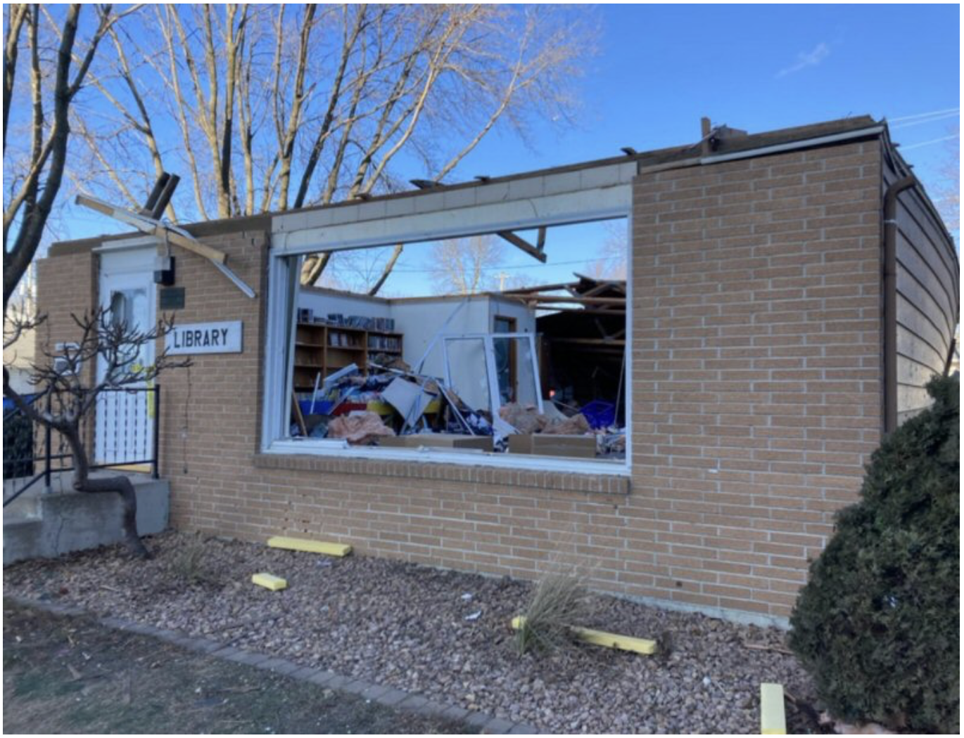
Later that night, tornadoes touched down near Mason City, Manly and Rudd. The next morning, North Iowa woke up to cold, snow showers and a landscape that looked nothing like the night before. The scene at Rudd was devastating — splintered homes, twisted trees and a town forever changed. Many residents spent days without power.
The abrupt shift from record warmth to winter chill reminded some longtime Iowans of the infamous F5 tornado that struck Charles City in 1968, followed by a burst of cold air and snow. Rarely does nature swing so violently in such a short span of time.
Why this night still matters
Of all the weather events in my life — the Groundhog Day Blizzard of 2011 in Milwaukee, the F4 tornado that narrowly missed my hometown of Denmark, Wisconsin, in 1994 — December 15, 2021 sits near or at the top. Not only because of its meteorological significance, but because of what it revealed about our relationship with the sky.
We rely on patterns. We expect winter to behave like winter. But on this day, the atmosphere broke every rule, reminding us that preparedness matters in every season — even one that’s supposed to be quiet.
For many Iowans, especially here in North Iowa, that night is etched into memory: the wind, the darkness, the hum of generators, the quiet shock the next morning as snowflakes drifted past toppled barns and uprooted trees.
Four years later, it remains a vivid reminder of how quickly life can change — and how resilient our communities truly are.
If you have memories from that night, photos, or stories you’d like to share, reach out to us on The Osage Oracle Facebook page. Your experiences are part of this history, too.
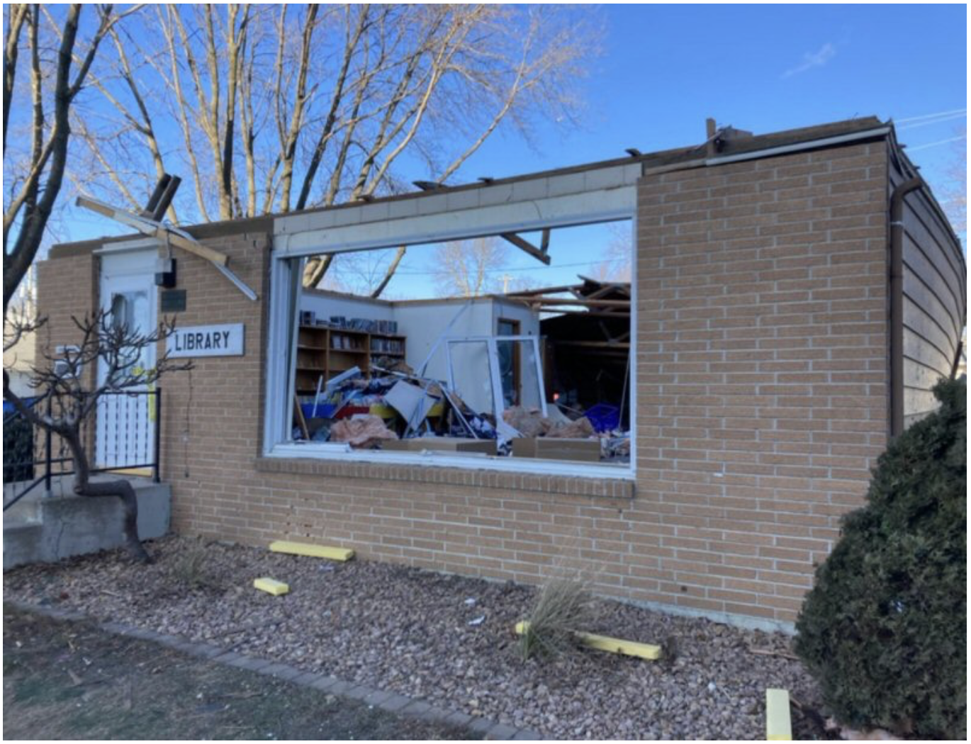
The Rudd Library was damaged severely the night when a tornado hit town. A new library was built a few years later.
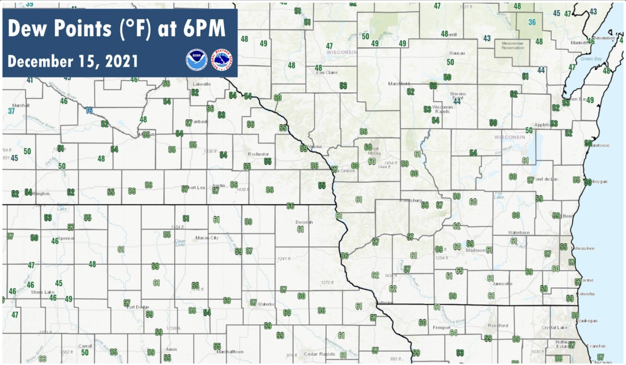
Dew points this high were record-shattering, which lead to the instability for thunderstorms.
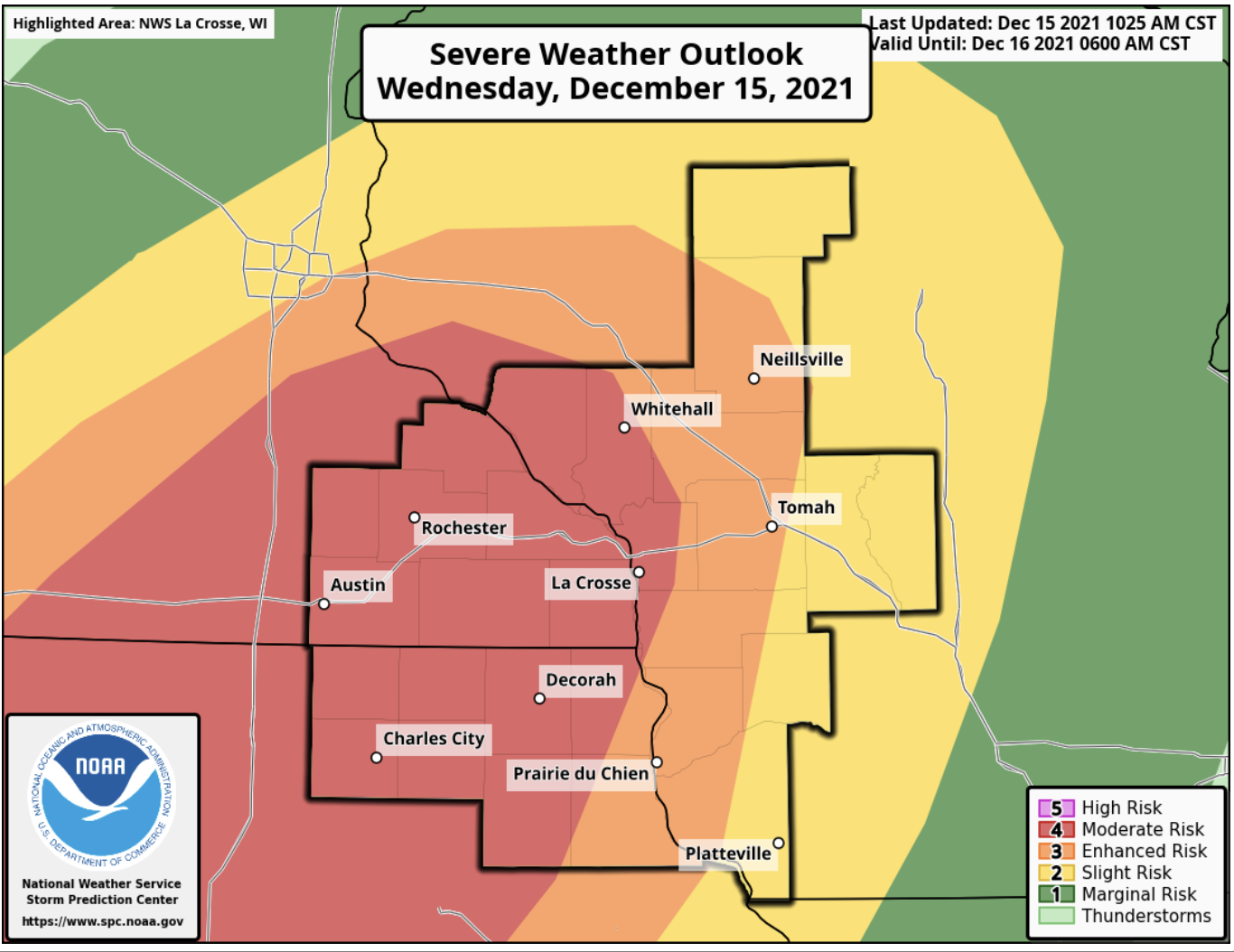
This was the first time in recorded history that a moderate threat of severe weather was issued in December for Iowa.
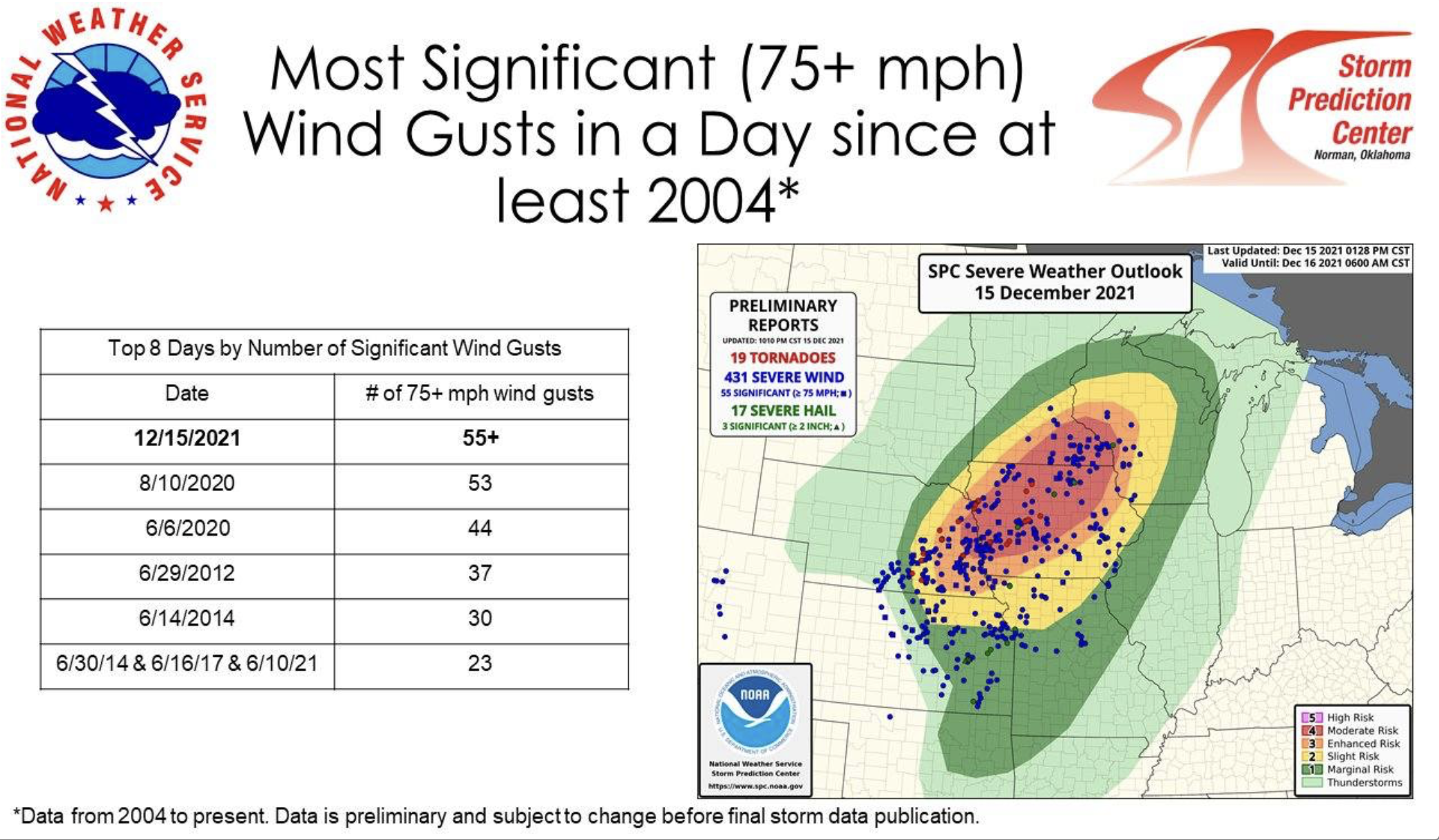
This marked the worst severe weather outbreak for wind in 17 years.

Temperatures broke records that day including several driving into the 70s south of Highway 20.
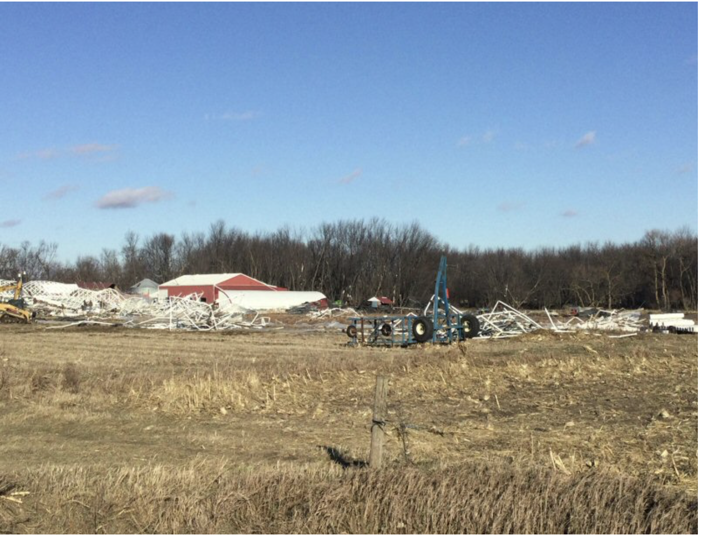
Elma, upon many other communities in North Iowa, were hit with damage from strong winds.
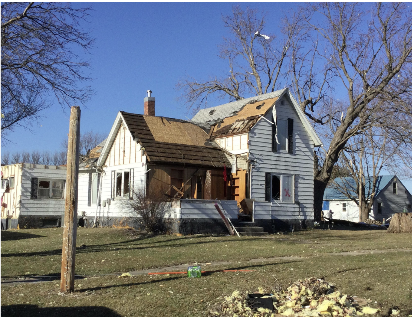
A home in Rudd is damaged by the tornado and wind that night.