

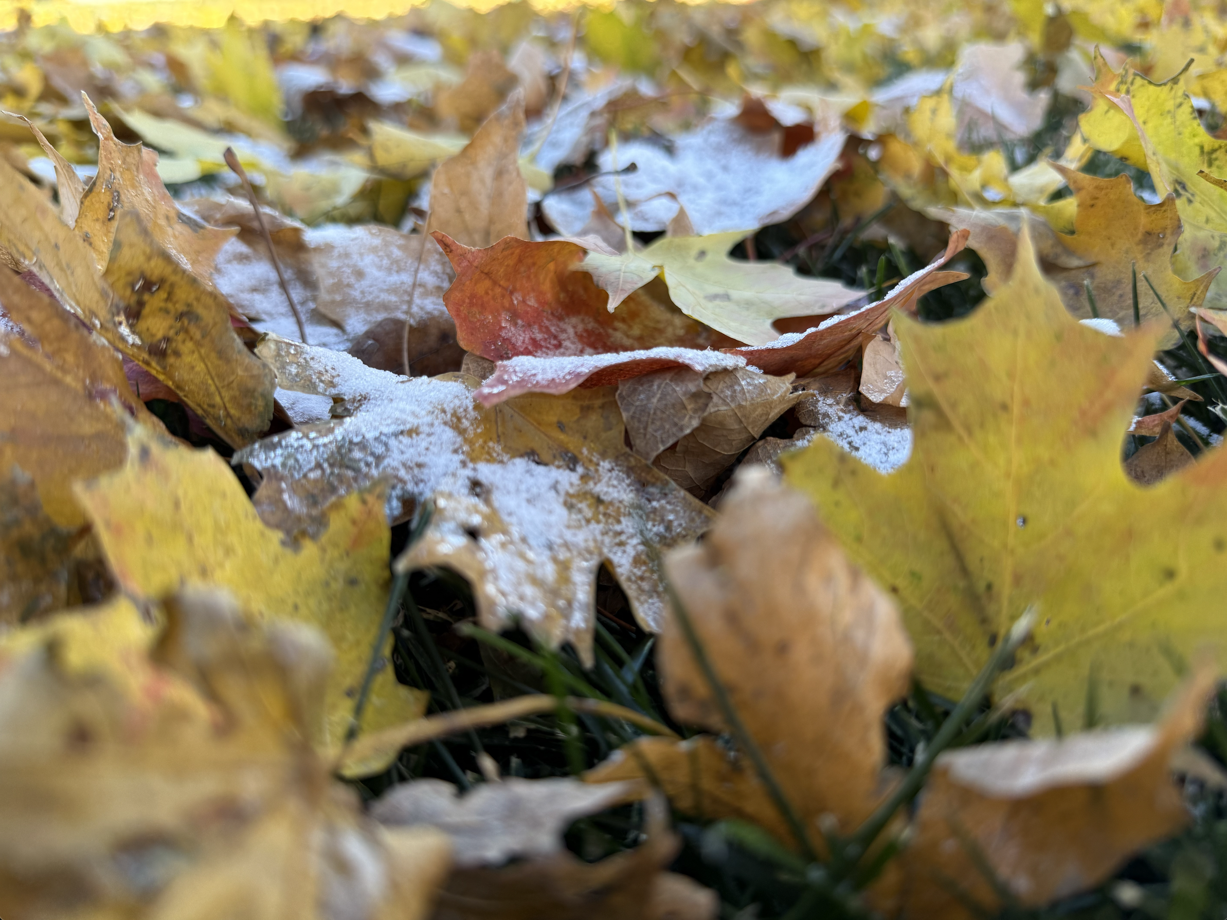
OSAGE, Iowa — Forty years ago this week, Osage and much of North Iowa were buried under nearly a foot of heavy, early-season snow — a storm that still stands as one of the region’s most memorable November weather events.
Between Nov. 8 and 9, 1985, a potent low-pressure system swept across the Upper Midwest, transforming a crisp autumn day into a full-blown winter landscape overnight. When the flakes finally stopped falling, Osage measured 9.5 inches of snow.
Nearby totals included 11.0 inches in Decorah, 10.0 in Cresco, 9.3 in Mason City, and 8.5 in New Hampton, according to the Midwestern Regional Climate Center. The heaviest snow fell north of Highway 20, with accumulations dropping off sharply farther south — Waterloo received just 1.4 inches, and Dubuque less than a half-inch.
For Osage, the 1985 storm marked an abrupt end to fall. Farmers were still wrapping up harvest, and many residents had yet to put away their rakes or mount snow tires. Roads across Mitchell County quickly became impassable as drifts built along open stretches of Highway 9 and rural routes. Schools and businesses closed, and families spent the weekend digging out.
“It was one of those snows that just didn’t stop,” longtime residents recall. “You went to bed with rain and woke up to winter.”
First Snow Arrives Again
This past weekend — almost to the day — Osage and the surrounding region experienced the first flakes of the 2025 season, with several locations across northern Iowa reporting flurries to a few inches of accumulation. While totals this year were far lighter, the timing serves as a reminder of how quickly conditions can change in November.
According to the National Weather Service, the Mason City Municipal Airport — the region’s official climate site — typically records its first measurable snowfall around November 20. That means both the 1985 storm and this year’s early snow arrived ahead of schedule.
Historically, however, North Iowa has seen snow much earlier. On September 25, 1942, between 2 and 6 inches of snow blanketed the region — including Osage — marking the earliest measurable snowfall ever recorded in this part of the state.
The Armistice Day Storm of 1940
Just imagine the biggest snowstorm of your lifetime — and then think of this one. Iowa endured one of its most infamous weather disasters: the Armistice Day Storm of 1940.
On November 11, 1940, a rapidly deepening low-pressure system raced northeast from Kansas City through the Upper Mississippi Valley into the Great Lakes, producing record-low barometric pressures of 28.92 inches in Charles City, 28.72 in La Crosse, and 28.66 in Duluth.
That morning dawned clear and mild, with temperatures in the 40s and 50s. Forecasts called for “colder temperatures and a few flurries.” Many Iowans — including duck hunters along the Mississippi River — set out in light jackets and short sleeves, only to be caught hours later in one of the worst blizzards of the century.
By mid-afternoon, temperatures had plunged into the teens. Rain changed to sleet, then to driving snow. Winds gusting over 50 mph created whiteout conditions that stranded motorists and trapped hunters on the river. Twelve men froze to death between St. Paul and Prairie du Chien after being marooned on small islands as waves and ice closed in.
Across the Upper Midwest, the storm left a staggering trail of destruction — 26.6 inches of snow in Collegeville, Minnesota, 20-foot drifts near Willmar, and 154 deaths in total. Iowa alone lost thousands of cattle, and more than a million turkeys were killed across Wisconsin, Minnesota, and Iowa as temperatures crashed into the single digits.
The disaster spurred sweeping changes in U.S. weather forecasting. At the time, the Chicago Weather Bureau handled forecasts for the entire region. After the Armistice Day Storm, forecasting duties were decentralized to regional centers — including Iowa — to provide timelier and more localized warnings.
For Osage and North Iowa, it remains a somber chapter in weather history — a reminder that the same cold fronts and pressure drops that define our November skies today have been shaping life here for generations.
A Timely Reminder
Meteorologists are always watching for early-season snowfalls like the one in 1985 — events that often develop when lingering autumn warmth collides with incoming Arctic air. Of course, we make it sound simple, but weather is anything but. The result can be rapid temperature drops, strong winds, and heavy, wet snow that sticks to trees and power lines.
As Osage enters another winter, the 40-year anniversary of that storm underscores a simple truth about life in Mitchell County: November can turn on a dime.
“It’s just part of living here,” one resident said. “You never really know if November will bring leaves or snow.”
At a Glance: Nov. 8–9, 1985 Snowfall Totals
Location | Snowfall |
Decorah | 11.0″ |
Cresco | 10.0″ |
Osage | 9.5″ |
Mason City | 9.3″ |
Northwood | 9.0″ |
Forest City | 9.0″ |
New Hampton | 8.5″ |
Waterloo | 1.4″ |
Dubuque | 0.4″ |
Chris C. Nelson writes “Weekly Front,” a weather column for The Osage Oracle that highlights notable climate events and local weather history. Anonymous quotes in this column are drawn from Mitchell County residents whose experiences illustrate the events described.
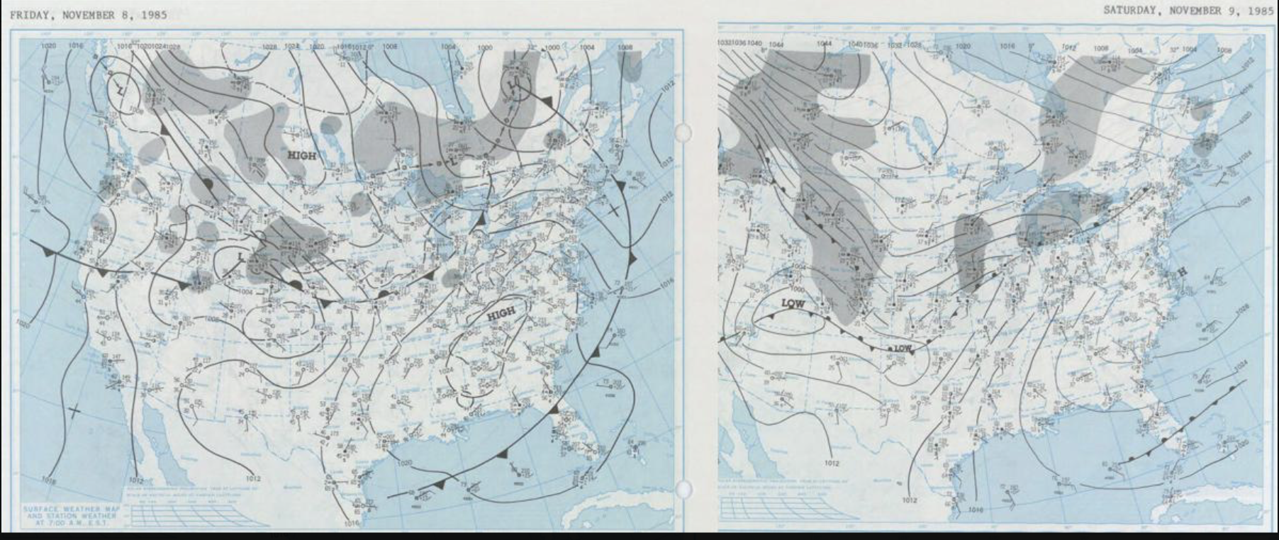
The overall United States view of surface analysis on both days of the 1985 early snowstorm.
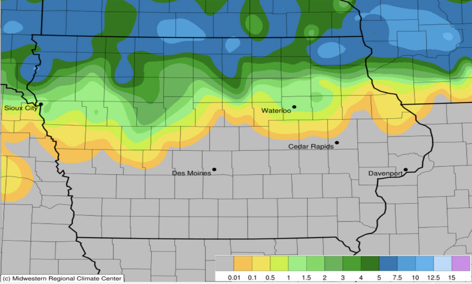
Graphic showing the amount of snow that fell across North Iowa by Monday morning of November 10th, 1985.
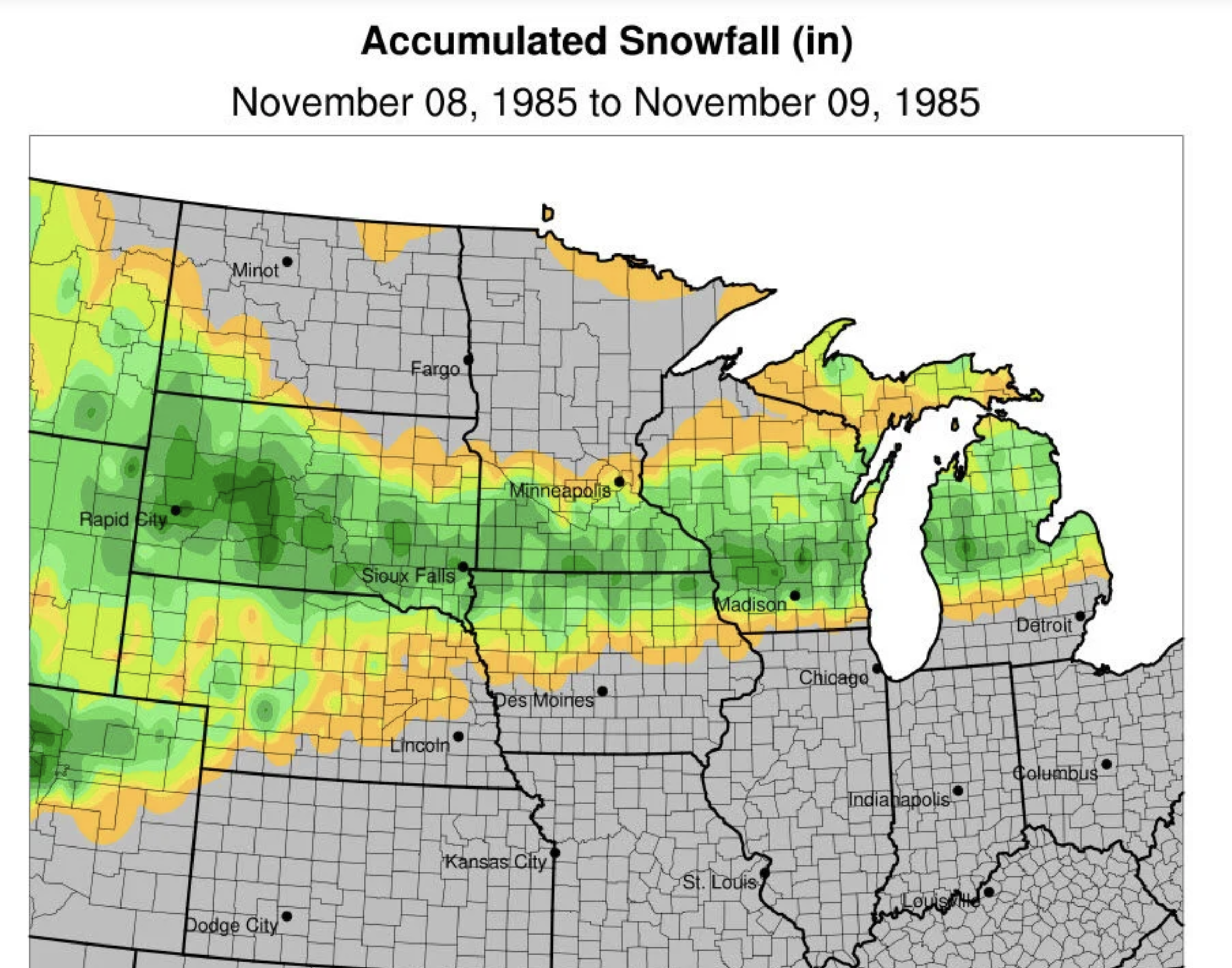
Zoomed-out view of the snowstorm's impact of November 8-9, 1985.